Getting involved in a Citizen Science project is a great way to contribute to knowledge and research. There are several options, depending what you might find interesting, and what fits your skills and capabilities.
Waterwatch

Waterwatch Victoria is a Citizen Science based water monitoring program. All the work is done by volunteers. It’s main value is education and public awareness. We welcome new groups or volunteers to join the Waterwatch program. Please contact us to find out more.
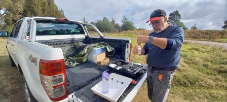
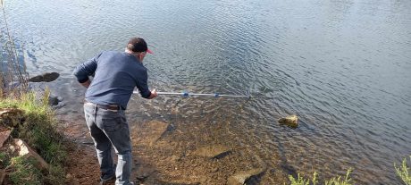
FOGL participates in Waterwatch, currently measuring at three sites. The data can be viewed by going to the Waterwatch data portal https://ww-data.waterwatch.org.au/ and selecting a site on the map. A screenshot of data from one of our sites is shown below. We have capability to measure phosphates and Nntrates ,pH, salinity, dissolved oxygen and turbidity.
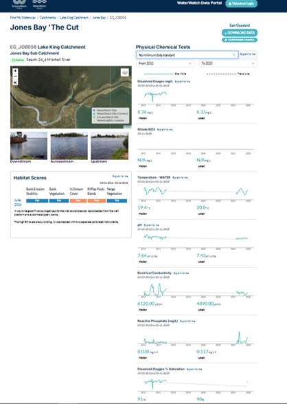
Waterwatch data can identify potential issues for reporting to the relevant authority to follow up. Around 15 years go there were over 100 active Waterwatch sites around the Gippsland Lakes. Only around 20 are still active.
Australian Marine Debris Initiative ( AMDI )
FoGL is partnering with Tangaroa Blue and AMDI to conduct research on marine litter and debris. We are running event in Lakes Entrance and other places around the Lakes. Please contact us if you’d like to know more or follow the link below
https://tangaroablue.org/about-amdi/
Phytoplankton Monitoring
This is new initiative to understand and find out more about microalgae in the Gippsland Lakes. We are at the very early stages.
This Citizen Science activity will be closely modelled on that of the Phytoplankton of South Australia Citizen Science initiative.
You can find out more by looking at their Facebook page.
Phyoplankton of South Australia Facebook Group
Other ways to get involved
Other groups also run Citizen Science projects to collect data that is important for research and knowledge. Contact them to find out more.
Birdlife East Gippsland run bird counts
Frog ID an app to record frog sightings and calls
Marine Mammal Foundation have research projects and dolphin counts in the Gippsland Lakes